Project Description
Meadow Lawn Farm Mitigation Bank
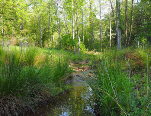
The scale and scope of any ecological intervention must be evaluated for the current condition and functioning versus the potential ecological functions capable of being supported within a resource. The areas in the floodplain were likely historically forested lowland areas with the potential for supporting wetland and stream ecosystems. They were converted to open/agricultural fields by a combination of ditching, recontouring (straightening), and filling.
Streams within the project area have altered from their natural condition due to manmade alterations (vegetation removal) and watershed land use changes associated with agricultural practices including impacts from livestock, rural development, and silviculture. Streams in the project area are currently impaired due to over-widening, a simplification of the bed-form, a reduction of hyporheic exchange, fine sediment aggradation, and excessive channel erosion from lateral migration and down cutting. These impairments have contributed to the degradation of aquatic and terrestrial life as well as water quality.
Impacts associated with crop production, and absent or narrow riparian buffers have contributed to a reduction of hyporheic exchange, fine sediment aggradation, excessive channel erosion, eliminated or degraded refugia and epifaunal substrate, limited shade and temperature regulation, and decreased or eliminated supply of organic matter for food and habitat.
The project purpose will be achieved by creating a self-sustaining natural aquatic system that achieves the intended level of aquatic ecosystem functionality with minimal human intervention, including long-term site maintenance. Due to the slopes and setting, streams are proposed that have morphological characteristics of a C and E channel according to Rosgen Stream Classification. The stream design was developed in conjunction with the wetland restoration design to ensure the conveyance of hydrology to the wetlands. Well data was used to calibrate a PCSWMM hydrologic model that integrates both shallow groundwater flow and surface hydrology to quantify floodplain outlet structures and volumes sufficient to maintain the proposed wetlands.
The project is being undertaken to develop a stream and wetland mitigation bank. In addition to stream and wetland restoration, the project will consist of removing livestock from streams, stream preservation, and riparian buffer restoration.
Goals
- Provide mitigation for unavoidable impacts to aquatic resources
- Restore and protect critical habitat
- Reduce impact from agricultural practices
- Enhance landscape connectivity
- Protect high functioning streams
- Provide long-term protection of restoration areas
Services: Regulatory, Plan Production and Mapping, Stream and Wetland Design, Mitigation Bank Development